


News
Identifying and protecting key wildlife corridors in KAZA
The Kavango-Zambezi Transfrontier Conservation Area (KAZA TFCA) is one of the world’s largest Transfrontier Conservation Initiatives, spanning 520 000 square kilometres across Botswana, Namibia, Zambia, Botswana, Angola and Zimbabwe. For conservation purposes, this region is divided into 6 key Wildlife Dispersal Areas (WDAs), with the aim of improving sustainable livelihood opportunities and securing connectivity for wildlife – two ideals that form the backbone of the KAZA initiative.
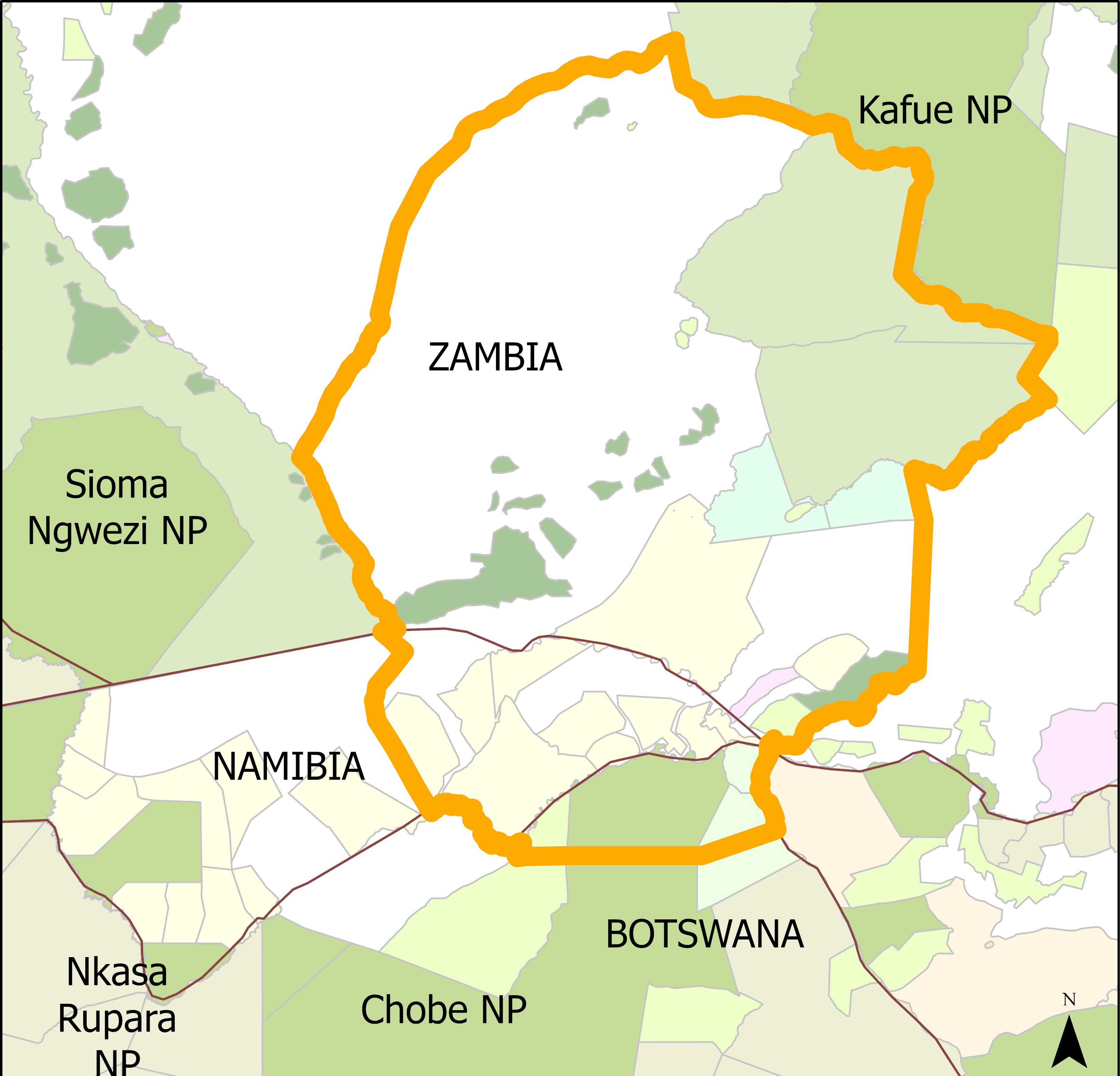
In 2022, the KAZA Secretariat initiated a project together with KAZA representatives from Namibia, Botswana and Zambia, for the Chobe Zambezi Floodplain WDA. The aim being to identify key corridors that could facilitate the movement of multiple species between Botswana’s Chobe National Park and Namibia’s Zambezi Region to the Greater Kafue area of Zambia. In doing so, the project would evaluate current and future land use plans for the area, and design projects to secure the future of the identified multi-species corridors.
The Trans-Kalahari Predator Programme (TKPP) was selected as a technical partner to assist in this endeavour, by providing the technical expertise necessary to model the multi-species corridors and provide a toolkit that could assess future impact of land use change or development on their viability. Under direction from the Secretariat and KAZA Desk Officers, the project team engaged with government, non-government and community representatives to identify opportunities and threats to the project, collate existing land use plans, identify land use conflicts and collect wildlife related data from across the region for modelling purposes.
The project then collaborated with Northern Arizona University (NAU), US Forest Service International Programme (USFS) and NASA on development of the user-friendly toolkit. This will provide longevity to the project, enabling stakeholders to continue assessing the impact of land use change on identified corridors, and incorporate this into land use planning.
After 18 months of data collection and analysis and stakeholder engagement under KAZA secretariat guidance, the project culminated in a multi-stakeholder workshop, with roughly 60 government, non-government and community representatives from Namibia, Botswana and Zambia. Stakeholders were presented with the corridor results for the Chobe Zambezi Floodplain, highlighting which areas were critical to facilitate movement for multiple species across the WDA and introduced to the toolkit.
Participants were then encouraged to collaboratively design projects aimed at improving sustainable livelihood options for local communities and encouraging protection and tolerance of wildlife to secure the corridors. The diverse range of opinions, experience and insights shared were condensed into achievable project plans. The best of these were selected by the Secretariat, and implementation will be supported with funding from the German Development Bank (KfW). This initiative served as a proof of concept for supporting similar projects across the rest of the KAZA landscape.
In 2024 the project team, with members from TKPP, NASA, NAU and USFS continue to support the KAZA Secretariat in identifying and prioritizing multi-species corridors and incorporating these into land use planning across the rest of the KAZA landscape.
-
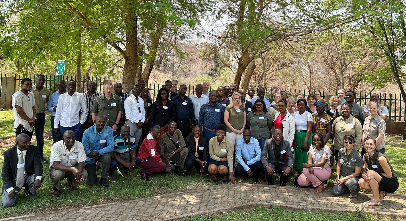 Stakeholders from the Chobe Zambezi Floodplain Integrated Land Use and Management Project consisted of government, non-government and community representatives from Botswana, Zambia and Namibia.
 -
 KAZA Wildlife Dispersal Areas
 -
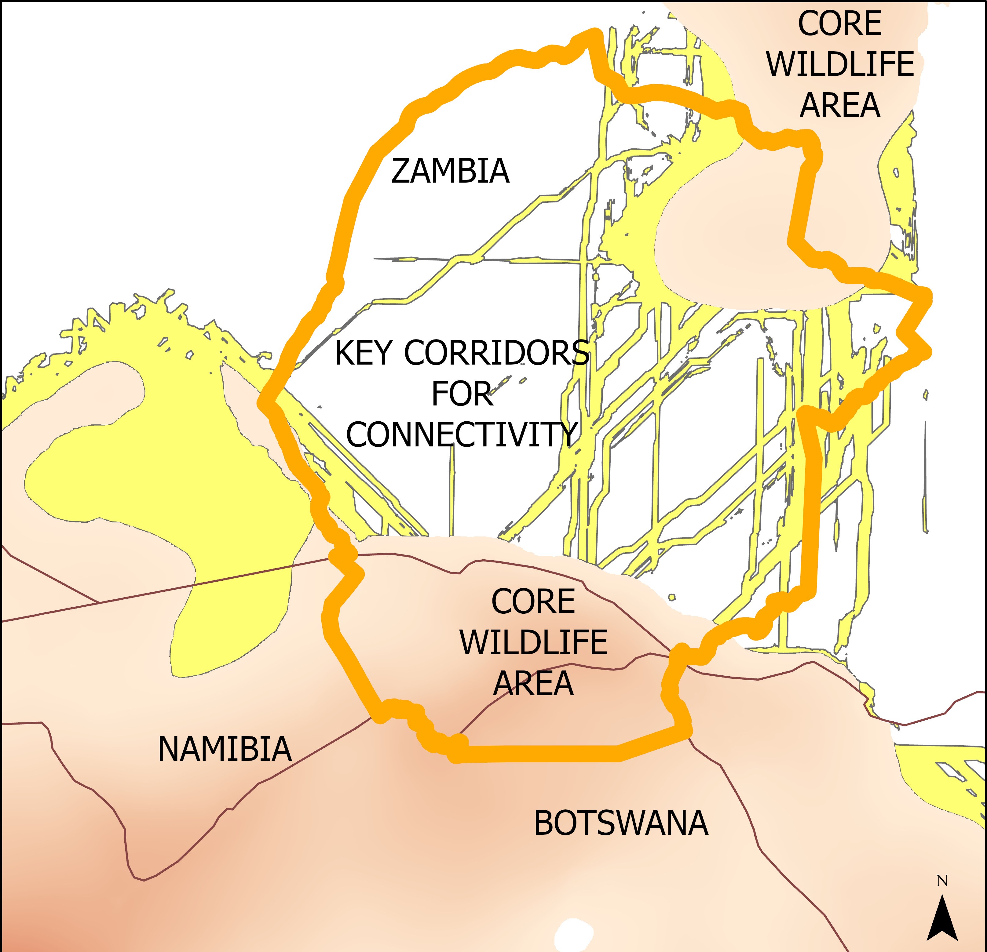 Cores and corridors