


News
Since the 1970s Borneo has lost a staggering 30% of its forests. What next?
The answer comes from a new study that will help conservation planners not only in Borneo, but for forests around the world. This novel approach models the factors associated with deforestation risk to predict the future, and therefore to plan more effectively.
The study is relevant to forests everywhere, but the researchers focused on those of Borneo because they are among the most biodiverse on the planet, and among the most threatened. The loss of Bornean forests threatens species such as the orangutan, Sumatran rhino and the Sunda clouded leopard as well as emitting significant amounts of carbon dioxide into the atmosphere.
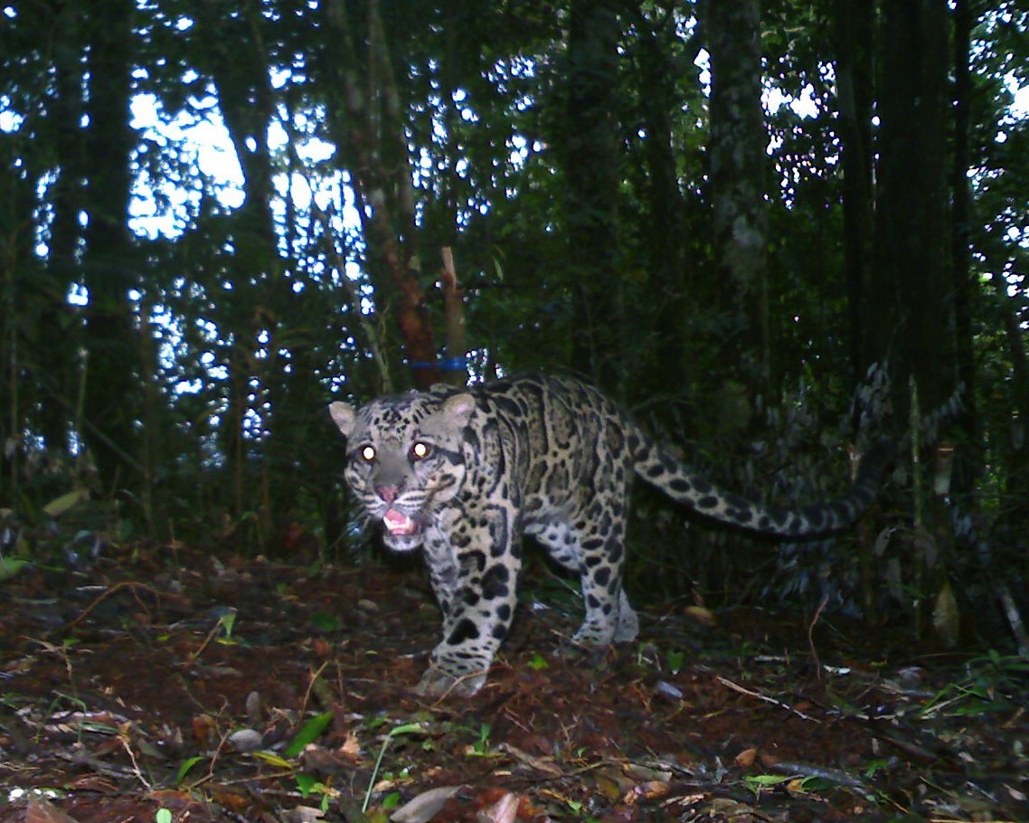
Photo of a Sunda clouded leopard captured as part of a WildCRU study into their ecology in Malaysian Borneo. Deforestation is one of the biggest threats to clouded leopards. (photo credit: Andrew Hearn)
The study was led by Dr Ewan Macdonald of Oxford University’s WildCRU and Dr Sam Cushman of the US Forest Service and is described in their paper entitled “Multiple-scale prediction of forest loss risk across Borneo” published in the journal Landscape Ecology.
The team used existing maps of different land use classes across Borneo to generate a map of forest loss between 2000 and 2010. They then looked at a range of landscape and geographic features to explore which attributes best correlated with this historic deforestation. The key innovation of this analysis is how the researchers combined these different landscape features in an explicitly multi-scale framework using the machine learning tool known as “Random Forests”. The team compared this new approach to more traditional approaches and found that it substantially improved the model predictions.
Mindful that those that fail to learn from history are doomed to repeat it, having calculated the historic links between landscape variables and deforestation, the team used this learning to predict the future deforestation risk facing Borneo’s remaining forests. Their very practical aim is to give national authorities a tool for planning a better future.
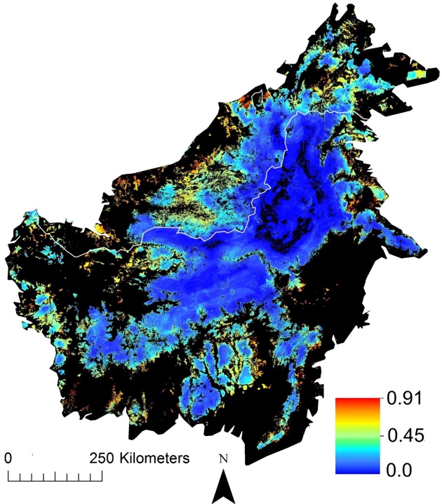
Map showing the predicted risk of deforestation across Borneo’s remaining forests. Red areas represent areas of highest risk.
The countries that comprise Borneo each had a different profile of deforestation risk factors. In Brunei deforestation was associated with a highly patchy landscape with multiple land uses within a 10km radius and a large amount of forest edge. In Malaysian provinces of Borneo, deforestation was associated with a high proportion of “lowland mosaic” landscape within 20km and high proportions of existing plantations within 30km, this led to a diffuse pattern of risk across Malaysian forests. In the Indonesian provinces of Borneo, deforestation was associated with areas of low elevation and a highly patchy landscape leading to strong frontiers of deforestation risk.
The results of this study confirm that this novel modelling framework is a powerful approach to analysing land use change. In addition, it highlights the immense and imminent risk to Borneo’s forests and its inhabitants, with clear spatial patterns of risk related to topography and landscape structure that differ between the three nations that comprise Borneo.
Ewan Macdonald who conceived this study during his DPhil in Oxford’s Environmental Change Institute (ECI) and is now Rivington Winant Post Doctoral Research Fellow in Conservation at WildCRU said:
“If we understand where risks lurk, we can plan action to counteract them. And these risks are real and imminent for many species, such as the beautiful and enigmatic Sunda clouded leopard, which are threatened by Borneo’s forest loss. I hope our understanding of the patterns of deforestation risk will provide a vital tool in developing effective conservation strategies.” He added “Our results provide the best insight to date of where the highest risks lie to Borneo’s remaining forests. I hope this will help governments and conservation planners to develop effective strategies to combat these risks and to conserve these beautiful forests for future generations”.
Sam Cushman, joint first author and Director of the Center for Landscape Science and Research Landscape Ecologist at the U.S. Forest Service Rocky Mountain Research Station said:
“It is well accepted that ecological processes interact across a range of scales both in time and space; despite this, very few studies have explicitly accounted for scale dependence in predictive modelling. This analysis highlights the power of multi scale approaches to land cover change modelling and we hope it will encourage other researchers to adopt this approach.”
Borneo’s majestic forests and glorious wildlife are beacons to the world and what’s so exciting about this study is that Borneo sheds a light to illuminate a way of helping tropical forests around the world. The innovation lies in a methodology that can be rolled out far beyond Borneo.
Read more about our Clouded Leopard Programme.
-
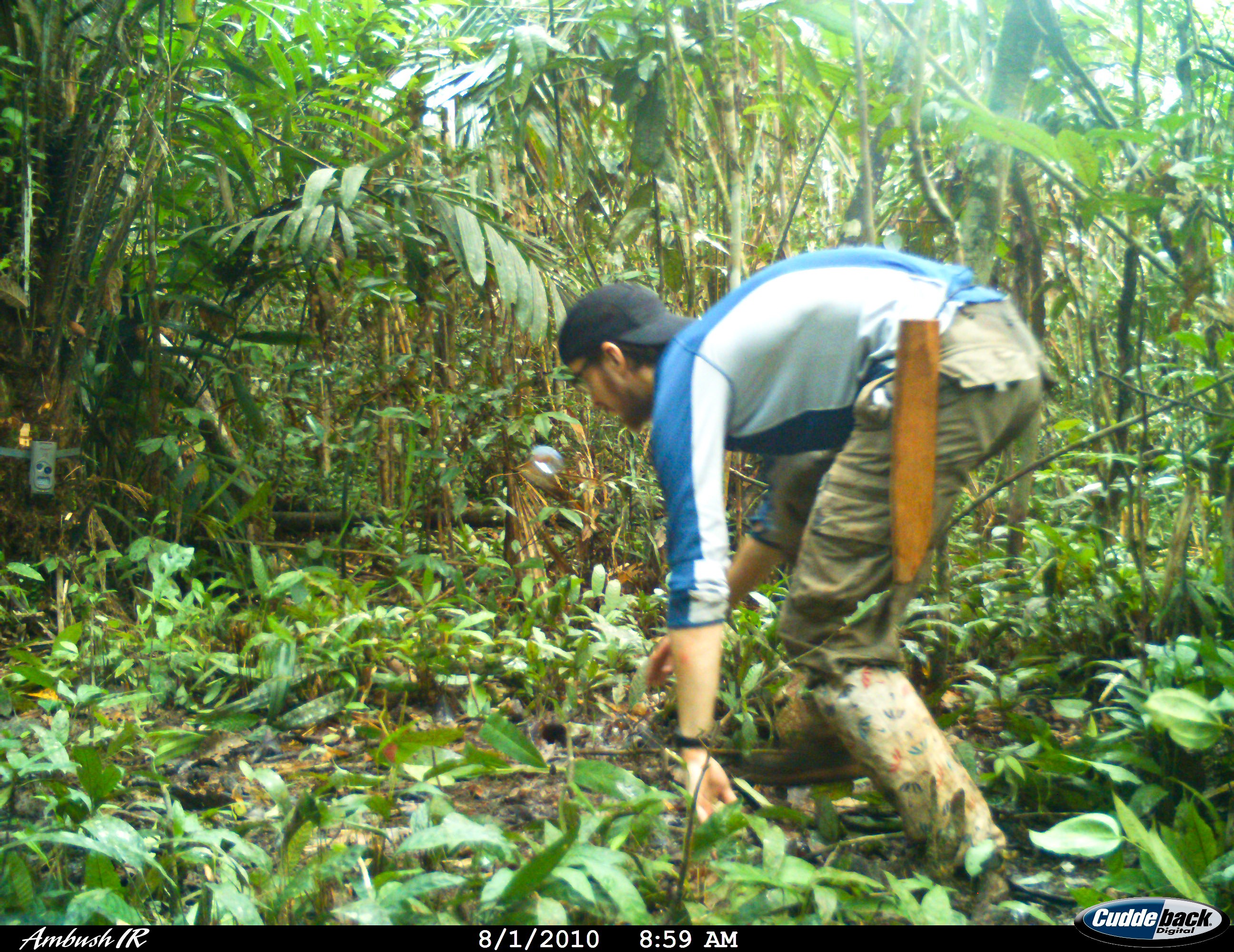 Ewan Macdonald setting camera traps for clouded leopards in Borneo. Researchers commonly move in front of the camera traps to mimic animals and ensure that the traps are set correctly.
 -
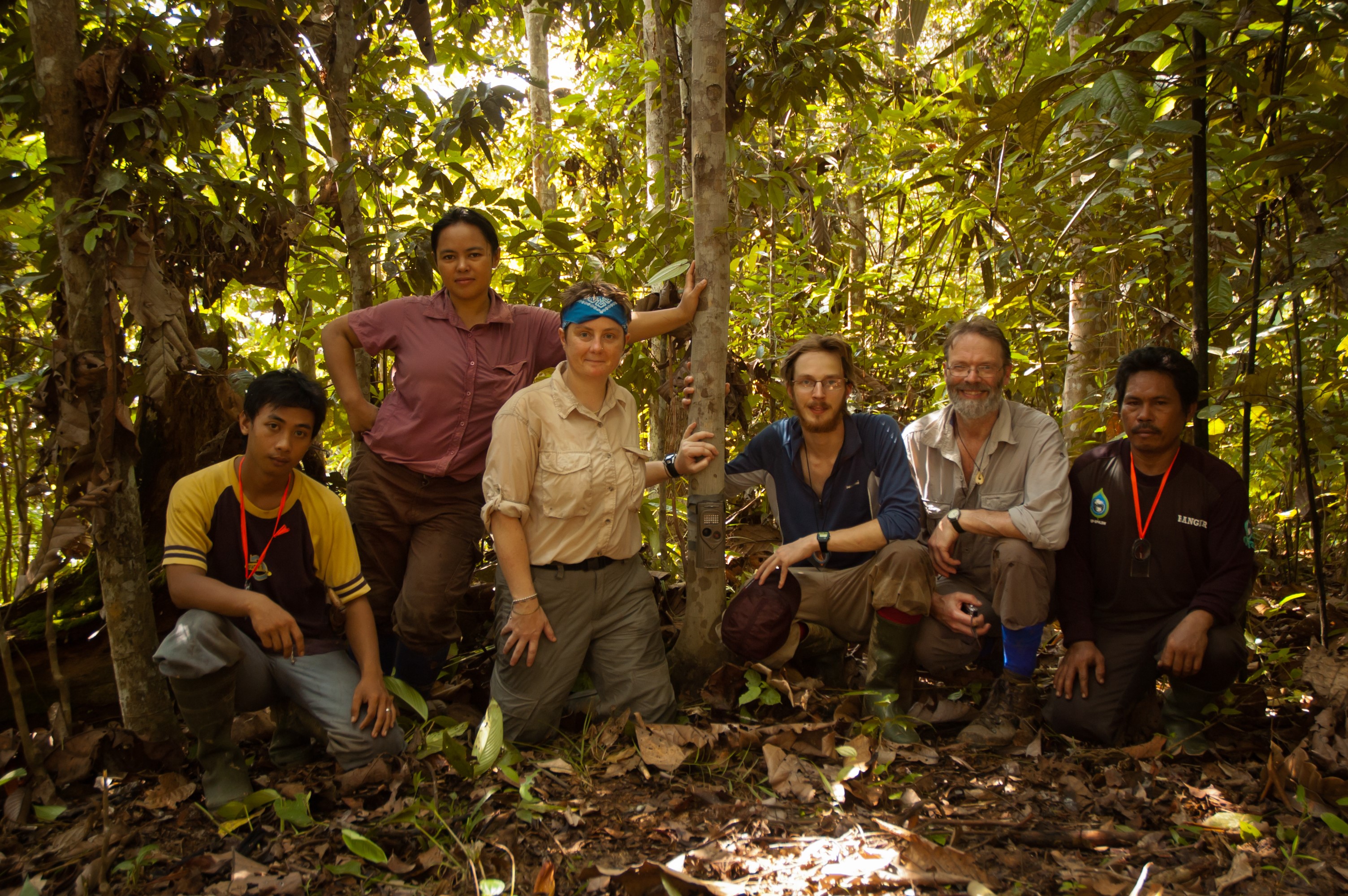 Ewan Macdonald (3rd from right) and David Macdonald (2nd from right) setting camera traps for clouded leopards with their team in Borneo.