Inspired by over 10 years of field research on big cats in Southeast Asia and Africa, in collaboration with colleagues at Northern Arizona University, supported by NASA, we developed an automated, user-friendly, online system revolutionising access to advanced wildlife connectivity models. Connecting Landscapes Decision Support System (CoLa DSS) becomes open access in 2025, enabling decision-makers to see how future changes might affect wildlife connectivity and to balance the needs of people with conservation.
CONSERVATION CONTEXT
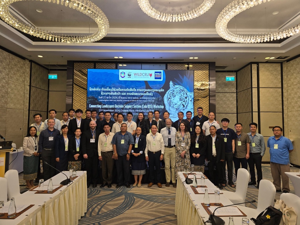
Where development meets biodiversity conservation, society faces tough decisions. Increasing loss and fragmentation of habitats requires the identification of areas for conservation that also maintain and enhance ecological connectivity of landscapes both within and between protected areas. Along with habitat fragmentation, infrastructure development can reduce landscape connectivity which threatens healthy, self-sustaining populations of wildlife. During 2024 and 2025, six preliminary training workshops in Asia, and two in Africa, involved 400 regional stakeholders, equipping them to predict the impact of development and landscape change on wildlife populations. The cascading influence through these stakeholders extends far beyond the conservation sector to development planners and a growing global constituency influencing non-profits and policy makers.
APPROACH
Analytical framework
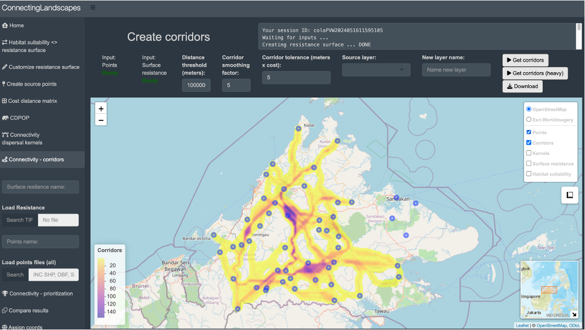
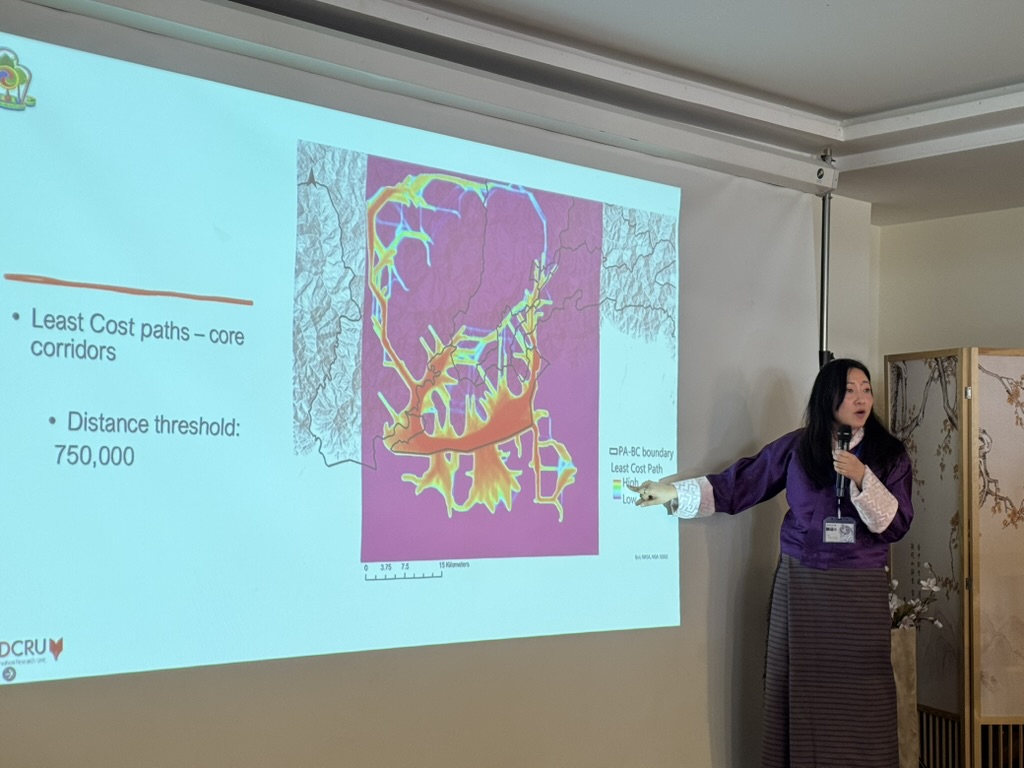
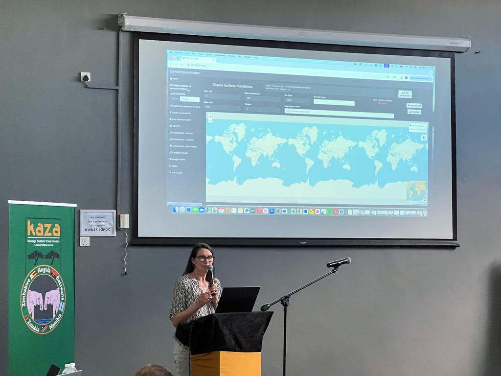
CoLa DSS is accessible through a graphical user interface, hosted on a cloud-based environment, enabling users to visualize the spatial inputs and outputs, and conduct advanced landscape connectivity and population analysis without requiring advanced local computing power. Sam Cushman is a key author of the analytical tools for connectivity analysis and conceived the workflow to bring these tools together in CoLa DSS. The key software programmes are UNICOR to implement cumulative resistance kernels and factorial least cost paths, and CDPOP to simulate gene flow and population responses in complex landscapes. Dr Patrick Jantz and Dr Ivan Gonzalez of Northern Arizona University built the graphical user interface and supported the implementation of all the training workshops.
Partner collaborations
Working with local and regional partners and collaborators we identify and co-develop spatial layers representing anticipated scenarios of landscape change. Simulations in CoLa DSS provide predictions of the impact of landscape change scenarios in terms of wildlife connectivity. Primary inputs for CoLa DSS include species distribution models or spatially explicit estimates of animal movement across different land use types. WildCRU’s habitat suitability movement models for the regions are developed from field-based research with empirical data from over 10 years of camera trapping across Southeast Asia and Africa, as well as movement data from collared Sunda clouded leopard in Sabah, and lions in the Chobe-Zambezi region of Zimbabwe and Botswana. Our Scottish wildcat programme is also using the same approach.
Open Access
Collaborators, stakeholders and other users with an interest in landuse planning, are invited to use CoLa DSS independently to carry out connectivity analyses and explore future scenarios. Users will be able to work with their own species distribution or movement models which can be easily uploaded into the system, or they are able to use the demonstration models prepared for target species or regions and pre-loaded by the Oxford team.
Explore CoLa
Please note that the following button takes you to Connecting Landscapes on GitHub where you will need to scroll down past the programming section to access the interface. You can try CoLa with the demo data online, or follow the instructions to run locally.
IMPACT HIGHLIGHTS
6 training workshops in 2024 in Brunei, Taiwan, Sabah Borneo, Laos PDR, Thailand and Bhutan, involving 300 regional stakeholders
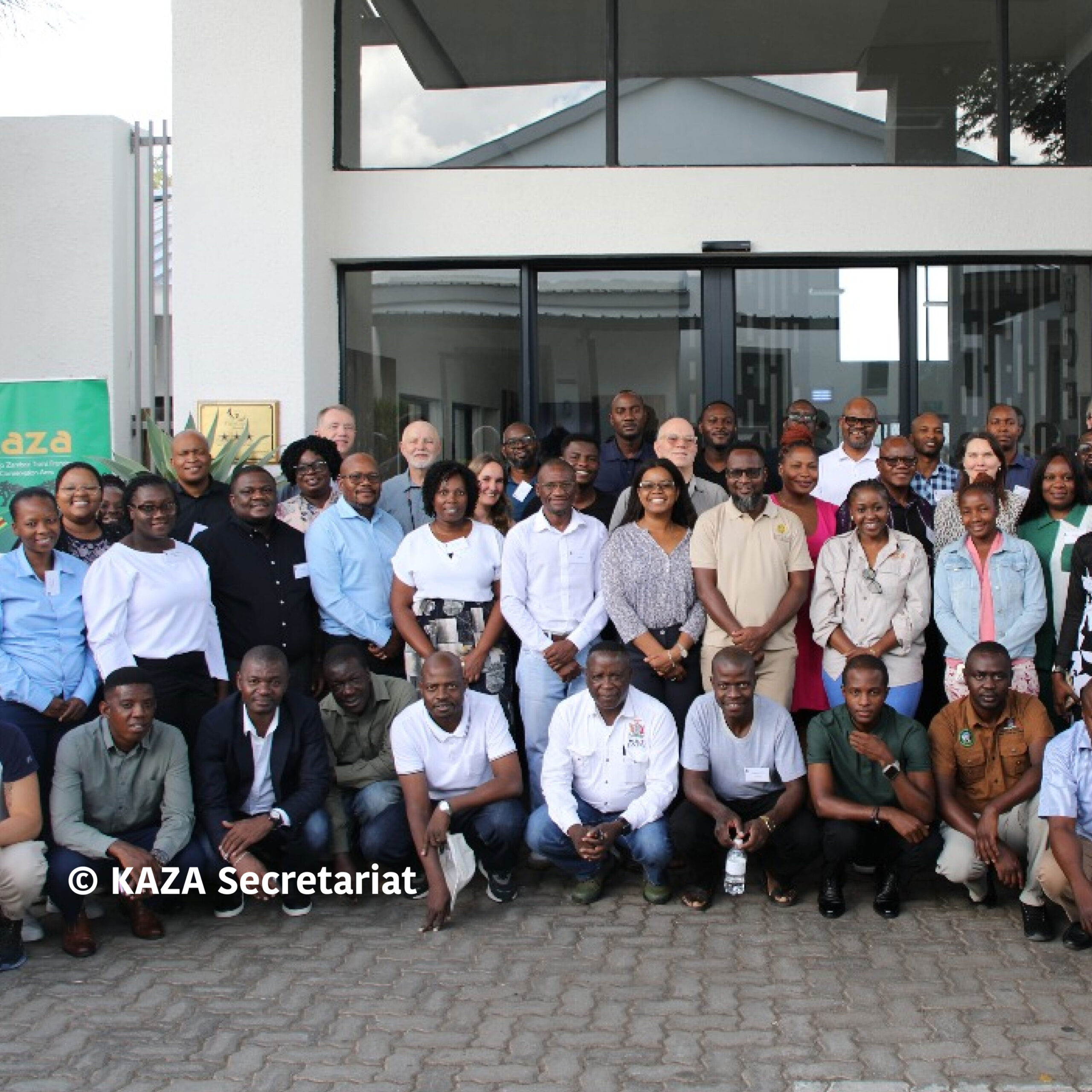
2 training workshops in Botswana, at the invitation of the Kavango Zambezi Transfrontier Conservation Area secretariat, involving 100 regional stakeholders from Angola, Botswana, Namibia, Zambia and Zimbabwe
Participation in the June 2025 ICCB workshop, exploring the Decision Support System with delegates
PROJECT MEMBERS
David Macdonald leads the Connecting Landscapes team at WildCRU, Dawn Burnham is research coordinator, Carol Sartor is a postdoctoral research associate. David Macdonald, Dawn Burnham, Sam Cushman and Zaneta Kaszta (WildCRU alumna) conceived the original idea for Connecting Landscapes Decision Support System. Andrew Loveridge, Andrew Hearn and Eric Ash (WildCRU alumnus) led field research and data collection in Zimbabwe and Botswana, Borneo and Thailand, respectively. WildCRU doctoral students Singye Wangmo, YiFeng Wang, Chrishen Gomez, Guilherme Alvarenga and Godfrey Mtare contribute their research and local expertise. Southeast Asian Felids Programme lists past researchers and students involved in data collection and workshops.
PROJECT PARTNERS